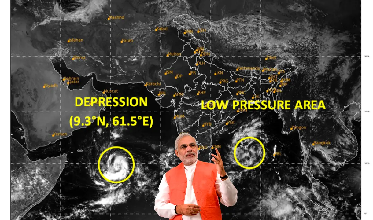
cyclone tej news:On Friday, October 20th, the North Indian Ocean region is on the verge of experiencing its first post-monsoon cyclone of the year as a low-pressure system in the Arabian Sea is approaching an intensification into a Severe Cyclonic Storm over the upcoming weekend.
The India Meteorological Department (IMD) reported that the low-pressure area, initially located in the southern Arabian Sea, has been steadily progressing westward, consolidating into a well-defined low-pressure area over the southwest Arabian Sea by midnight on Friday.
As of 8:30 AM on Friday, it has further developed into a depression, and the latest data positions it in the southwest Arabian Sea, approximately 920 km east-southeast of Socotra (Yemen), 1190 km southeast of Salalah Airport (Oman), and 1280 km east-southeast of Al Ghaidah (Yemen).
|
tej cyclone live tracking: Cyclone Tej Live Tracker Map on Windy |

The projected path indicates a west-northwest movement, with forecasts suggesting that it will intensify into a Cyclonic Storm over the southwest Arabian Sea within the next 24 hours.
When officially recognized, this system will be designated as ‘Cyclone Tej,’ becoming the third cyclone of the year in the North Indian Ocean, following Cyclone Mocha in the Bay of Bengal in May and Cyclone Biparjoy in the Arabian Sea in June.
Cyclone Tej is expected to continue its west-northwestward trajectory and could potentially reach Severe Cyclonic Storm status by the evening of Sunday, October 22. According to IMD forecasts, its peak intensity is anticipated late Sunday night, with maximum sustained wind speeds of 105-115 kmph, gusting up to 125 kmph.
|
Aadhar Card Loan Rs 50000 just 10 minutes apply online from here. |
Depression over southwest Arabian Sea moved westwards and lay centered at 1130 hours IST of today, over the same region, about 900 km east-southeast of Socotra (Yemen), 1170 km southeast of Salalah Airport (Oman). Likely to intensify into a cyclonic storm during next 24 hours. pic.twitter.com/g5sx5KlURn
— India Meteorological Department (@Indiametdept) October 20, 2023
Following this phase, it is projected to shift its course to the north-northwest, starting on the morning of the 24th, moving towards the coasts of south Oman and adjacent regions of Yemen, where a landfall currently appears likely.


